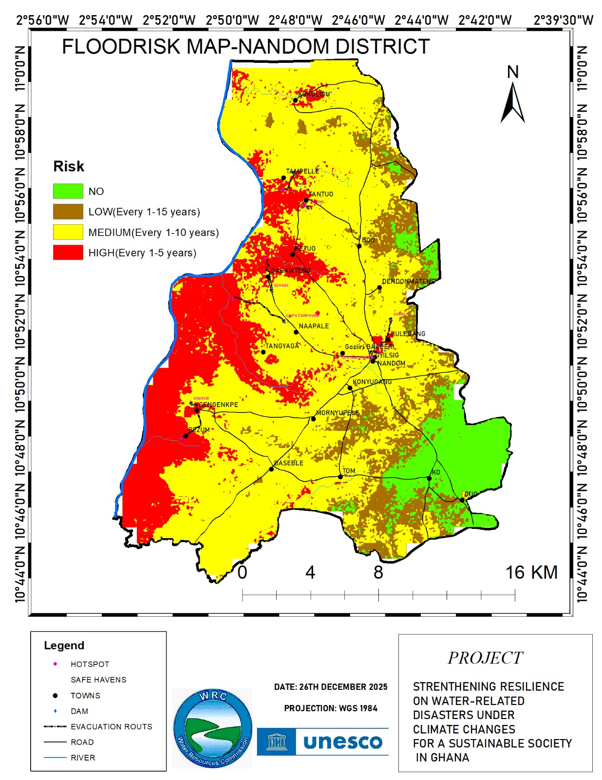
The flood risk map of Nandom District provides a spatial representation of areas susceptible to flooding based on frequency and intensity. The map categorizes flood risk into four classes: no risk, low risk, medium risk, and high risk. These classifications are essential for understanding the vulnerability of different communities and for planning effective disaster risk reduction strategies.